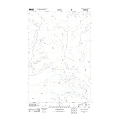
2011 Map of Berge Peak
USGS Topo · Published 2011About this map
Berge Peak and Pegleg Mountain define the high terrain of this Idaho-Montana border region during the early 21st century. The landscape is characterized by a dense network of watercourses and ridges, where the headwaters of Broadaxe Creek, Simmons Creek, and Gold Creek carve through the deep mountain geography. High-elevation features like Lenore Lake and Moore Lake sit tucked away near the peaks, while Summit Springs and Brushy Spr provide water sources along the steep slopes.
Find a feature on this map
32 named features on this map. Tap any name to fly to it.
Don’t see what you’re looking for? This feature index may not catch every label — zoom into the map to look around manually.
Map Details
Editions of this 2011 Berge Peak Map
This is the sole edition of this map. No revisions or reprints were ever made.
Other maps of this area

1918 · St Regis
USGS Topo · 1:125,000

1919 · St. Regis
USGS Topo · 1:125,000

1956 · St Regis
USGS Topo · 1:62,500

1956 · Wallace
USGS Topo · 1:250,000

1957 · Illinois Peak
USGS Topo · 1:62,500

1957 · Haugan
USGS Topo · 1:62,500

1957 · Simmons Peak
USGS Topo · 1:62,500

1960 · Wallace
USGS Topo · 1:250,000
1988 · Sherlock Peak
USGS Topo · 1:24,000
1988 · Peggy Peak
USGS Topo · 1:24,000