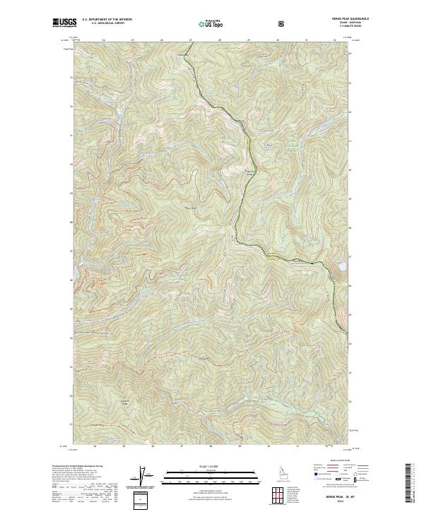
2024 Map of Berge Peak
USGS Topo · Published 2024About this map
Berge Peak stands at the center of this high-elevation landscape, where the state boundary between Idaho and Montana follows the crest of the Bitterroot Range. This 2024 survey documents a rugged backcountry managed by the St. Joe National Forest and Lolo National Forest. The map detail reveals an extensive network of off-highway vehicle trails and national forest roads, such as the Berge Peak OHV Trail and National Forest Development Road 391, which navigate the steep drainage systems of Float Creek and Simmons Creek.
Find a feature on this map
62 named features on this map. Tap any name to fly to it.
Don’t see what you’re looking for? This feature index may not catch every label — zoom into the map to look around manually.
Map Details
Editions of this 2024 Berge Peak Map
This is the sole edition of this map. No revisions or reprints were ever made.
Other maps of this area

1918 · St Regis
USGS Topo · 1:125,000

1919 · St. Regis
USGS Topo · 1:125,000

1956 · St Regis
USGS Topo · 1:62,500

1956 · Wallace
USGS Topo · 1:250,000

1957 · Illinois Peak
USGS Topo · 1:62,500

1957 · Haugan
USGS Topo · 1:62,500

1957 · Simmons Peak
USGS Topo · 1:62,500

1960 · Wallace
USGS Topo · 1:250,000
1988 · Sherlock Peak
USGS Topo · 1:24,000
1988 · Peggy Peak
USGS Topo · 1:24,000