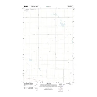
2011 Map of Bergen
USGS Topo · Published 2011About this map
Verendrye and Bergen anchor this McHenry County landscape, showing a pattern of settlement defined by a precise grid of rural roads. The area is characterized by scattered wetlands and the prominent Hogback Ridge in the southeast. Cultural and genealogical history is well-represented through multiple community landmarks, including the Verendrye Cemetery, Saint John Cemetery, and Norwegian Cemetery. Near the townsite of Verendrye, the David Thompson Memorial serves as a reminder of early exploration in the Red River Valley and northern plains. The map's grid, composed of routes like 49th St N and 7th Ave N, illustrates the orderly division of the North Dakota prairie for agricultural use, connecting these small settlements and their local burial grounds across the open terrain.
Find a feature on this map
21 named features on this map. Tap any name to fly to it.
Don’t see what you’re looking for? This feature index may not catch every label — zoom into the map to look around manually.
Map Details
Editions of this 2011 Bergen Map
This is the sole edition of this map. No revisions or reprints were ever made.
Other maps of this area

1929 · Kongsberg
USGS Topo · 1:62,500

1929 · Balfour
USGS Topo · 1:62,500

1948 · Voltaire
USGS Topo · 1:24,000

1948 · Velva
USGS Topo · 1:62,500

1949 · Simcoe
USGS Topo · 1:24,000

1949 · Voltaire
USGS Topo · 1:24,000

1949 · Karlsruhe NW
USGS Topo · 1:24,000

1950 · Karlsruhe NE
USGS Topo · 1:24,000

1951 · Velva
USGS Topo · 1:62,500

1954 · Minot
USGS Topo · 1:250,000