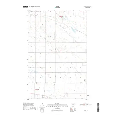
2017 Map of Bergen
USGS Topo · Published 2017About this map
Verendrye and Karlsruhe anchor this portion of McHenry County, where the landscape is defined by the glacial pockmarks and coulees typical of the Souris River region. The settlement of Bergen sits near the southern boundary, marked by its simple grid of Main St and Townsend St. This 2017 study reveals a deeply rooted rural community, where the placement of the Verendrye Cem, Saint John Cem, Bethel Cem, and Norwegian Cem reflects the distinct heritage of the homesteaders who organized this prairie. The terrain rises toward the east at Hogback Ridge, providing a significant topographical break in an area otherwise characterized by numerous small wetlands and seasonal basins.
Find a feature on this map
26 named features on this map. Tap any name to fly to it.
Don’t see what you’re looking for? This feature index may not catch every label — zoom into the map to look around manually.
Map Details
Editions of this 2017 Bergen Map
This is the sole edition of this map. No revisions or reprints were ever made.
Other maps of this area

1929 · Kongsberg
USGS Topo · 1:62,500

1929 · Balfour
USGS Topo · 1:62,500

1948 · Voltaire
USGS Topo · 1:24,000

1948 · Velva
USGS Topo · 1:62,500

1949 · Simcoe
USGS Topo · 1:24,000

1949 · Voltaire
USGS Topo · 1:24,000

1949 · Karlsruhe NW
USGS Topo · 1:24,000

1950 · Karlsruhe NE
USGS Topo · 1:24,000

1951 · Velva
USGS Topo · 1:62,500

1954 · Minot
USGS Topo · 1:250,000