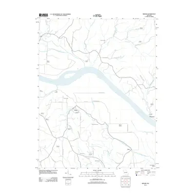
2012 Map of Berger
USGS Topo · Published 2012About this map
The Missouri River carves a diagonal path through this part of Franklin County, defining the low-lying agricultural landscape of Berger Bottom and Rush Island. The town of Berger serves as a central hub for the surrounding rural area, where the terrain transitions from river flats to the rising hills of the Northeastern Ozarks in the southeast. A dense concentration of family and community burial grounds, such as Saint Pauls Cemetery, Bade Cemetery, and the Reinhardt Cemetery, suggests a long-settled landscape with deeply rooted family histories.
Find a feature on this map
62 named features on this map. Tap any name to fly to it.
Don’t see what you’re looking for? This feature index may not catch every label — zoom into the map to look around manually.
Map Details
Editions of this 2012 Berger Map
This is the sole edition of this map. No revisions or reprints were ever made.
Other maps of this area

1890 · Hermann
USGS Topo · 1:125,000

1936 · Hermann
USGS Topo · 1:48,000

1942 · Hermann
USGS Topo · 1:62,500

1942 · New Florence
USGS Topo · 1:62,500

1943 · Warrenton
USGS Topo · 1:62,500

1945 · Hermann
USGS Topo · 1:62,500

1945 · Warrenton
USGS Topo · 1:62,500

1946 · New Florence
USGS Topo · 1:62,500

1948 · Washington
USGS Topo · 1:62,500

1949 · Saint Louis
USGS Topo · 1:250,000