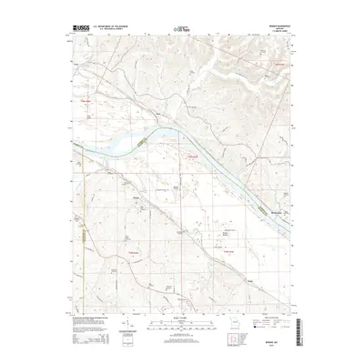
2015 Map of Berger
USGS Topo · Published 2015About this map
Berger serves as a central point in this Missouri River landscape, situated where the river plains meet the southern uplands. The terrain is defined by the sweeping course of the Missouri River and its accompanying wetlands like Loutre Slough, which separate the mainland from Rush Island. This area across Franklin, Gasconade, and Warren counties is notable for its high density of family and community burial grounds, reflecting a long history of local settlement. Numerous sites including Saint Johns Cemetery, Kallmeyer Cemetery, and the Reinhardt Cemetery are distributed across the hills and bottoms. The northern bank features the Katy Trl, utilizing the former rail corridor near the small settlements of Case and Gore. The agricultural character of the river valley is evident in the naming of Berger Bottom and the grid of rural roads like Sprecklemeyer Rd and Diederich Rd.
Find a feature on this map
71 named features on this map. Tap any name to fly to it.
Don’t see what you’re looking for? This feature index may not catch every label — zoom into the map to look around manually.
Map Details
Editions of this 2015 Berger Map
This is the sole edition of this map. No revisions or reprints were ever made.
Other maps of this area

1890 · Hermann
USGS Topo · 1:125,000

1936 · Hermann
USGS Topo · 1:48,000

1942 · Hermann
USGS Topo · 1:62,500

1942 · New Florence
USGS Topo · 1:62,500

1943 · Warrenton
USGS Topo · 1:62,500

1945 · Hermann
USGS Topo · 1:62,500

1945 · Warrenton
USGS Topo · 1:62,500

1946 · New Florence
USGS Topo · 1:62,500

1948 · Washington
USGS Topo · 1:62,500

1949 · Saint Louis
USGS Topo · 1:250,000