
1950 Map of Bering Glacier A-3
USGS Topo · Published 1952About this map
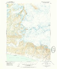
The massive ice flows of the Guyot Glacier and Yakataga Glacier dominate this 1950s survey of the Alaskan coast. The landscape is defined by the high elevations of the Robinson Mountains, where prominent summits like Mt Eberly, Munday Peak, and Mt McPherson rise above the glacial ice and snowfields. As these glaciers descend toward the Gulf of Alaska, they feed a network of coastal drainages including the White River, Munday Creek, and Johnston Creek. Evidence of human presence is minimal in this wilderness, though a lonely Cabin is marked along the shoreline near Umbrella Reef. This map illustrates the dramatic glacial retreat and hydrological patterns of the mid-century, capturing the transition from high alpine peaks to the narrow coastal plain.
Find a feature on this map
24 named features on this map. Tap any name to fly to it.
Don’t see what you’re looking for? This feature index may not catch every label — zoom into the map to look around manually.
Map Details
Editions of this 1950 Bering Glacier A-3 Map
2 editions found
Other maps of this area

1948 · Icy Bay D-2 and D-3
USGS Topo · 1:63,360

1948 · Bering Glacier A-4
USGS Topo · 1:63,360

1950 · Bering Glacier
USGS Topo · 1:250,000

1950 · Icy Bay
USGS Topo · 1:250,000

1951 · Icy Bay D-2 and D-3
USGS Topo · 1:63,360

1951 · Icy Bay
USGS Topo · 1:250,000

1951 · Bering Glacier
USGS Topo · 1:250,000
1951 · Bering Glacier A-4
USGS Topo · 1:63,360

1951 · Bering Glacier A-2
USGS Topo · 1:63,360
1959 · Icy Bay D-2 and D-3
USGS Topo · 1:63,360