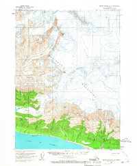
1959 Map of Bering Glacier A-3
USGS Topo · Published 1967About this map
Glacial ice dominates this 1950s landscape, where massive flows like the Yakataga Glacier and Guyot Glacier descend from the high Robinson Mountains toward the southern coastline. The terrain is defined by extreme elevation changes, from the jagged heights of Munday Peak and Mount Eberly down to the sea-level flats along the Gulf of Alaska. Near the coast, several Cabins and a singular Oil Well reflect early industrial and subsistence activity in this remote region. The drainage network is complex, with meltwater feeding into named systems like the White River and Munday Creek. This map captures a specific moment in the mid-century before significant glacial retreat, documented through photogrammetric methods that highlight the dense crevasses and moraines of the Eberly Glacier and Yaga Glacier.
Find a feature on this map
27 named features on this map. Tap any name to fly to it.
Don’t see what you’re looking for? This feature index may not catch every label — zoom into the map to look around manually.
Map Details
Editions of this 1959 Bering Glacier A-3 Map
2 editions found
Other maps of this area

1948 · Icy Bay D-2 and D-3
USGS Topo · 1:63,360

1948 · Bering Glacier A-4
USGS Topo · 1:63,360

1950 · Bering Glacier A-3
USGS Topo · 1:63,360

1950 · Bering Glacier
USGS Topo · 1:250,000

1950 · Icy Bay
USGS Topo · 1:250,000

1951 · Icy Bay D-2 and D-3
USGS Topo · 1:63,360

1951 · Icy Bay
USGS Topo · 1:250,000

1951 · Bering Glacier
USGS Topo · 1:250,000
1951 · Bering Glacier A-4
USGS Topo · 1:63,360

1951 · Bering Glacier A-2
USGS Topo · 1:63,360