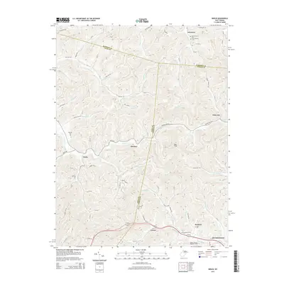
2014 Map of Berlin
USGS Topo · Published 2014About this map
Johnstown and Berlin sit within a landscape of winding hollows and ridges where the boundaries of Harrison, Lewis, and Upshur counties converge. The terrain is defined by a dense network of watercourses, including Stonecoal Cr and Hackers Cr, which have historically shaped the road patterns and small settlements like Aberdeen and Lorentz. For those tracing local families, the map identifies several burial grounds such as Old Johnstown Cem and the Morrison Cem. To the southeast, the geography transitions toward the more developed area surrounding Buckhannon, where the Upshur County Regional Airport is situated. The intricate relief, marked by features like Bear Knob and Coon Fork, reflects the classic Appalachian plateau character of north-central West Virginia.
Find a feature on this map
47 named features on this map. Tap any name to fly to it.
Don’t see what you’re looking for? This feature index may not catch every label — zoom into the map to look around manually.
Map Details
Editions of this 2014 Berlin Map
This is the sole edition of this map. No revisions or reprints were ever made.
Other maps of this area

1893 · Buckhannon
USGS Topo · 1:125,000

1896 · Buckhannon
USGS Topo · 1:125,000

1897 · Buckhannon
USGS Topo · 1:125,000

1904 · Philippi
USGS Topo · 1:62,500

1904 · Weston
USGS Topo · 1:62,500

1912 · Sago
USGS Topo · 1:48,000

1912 · Crawford
USGS Topo · 1:48,000

1914 · Sago
USGS Topo · 1:62,500

1914 · Crawford
USGS Topo · 1:62,500

1925 · Philippi
USGS Topo · 1:62,500