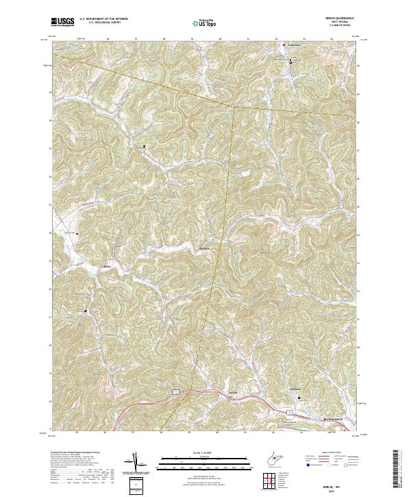
2023 Map of Berlin
USGS Topo · Published 2023About this map
Hackers Creek winds through a landscape of narrow hollows and ridge-top settlements in this portion of Lewis and Upshur Counties. The community of Berlin sits at the junction of Berlin Rd and Laurel Lick Rd, while the village of Lorentz serves as a southern anchor along the corridor of Weston Rd. The map illustrates a classic Appalachian settlement pattern where family history is etched into the terrain through numerous small burial grounds, including the Morrison Cem, Reger Cem, and the dual Old Johnstown Cem and New Johnstown Cem sites near the northern border. To the southeast, the terrain transitions toward the city of Buckhannon, with the Upshur County Regional Airport established in the valley of Fink Run. Numerous small waterways such as Bloody Run and Bull Lick define the many branching valleys that have shaped local transport and land use for generations.
Find a feature on this map
120 named features on this map. Tap any name to fly to it.
Don’t see what you’re looking for? This feature index may not catch every label — zoom into the map to look around manually.
Map Details
Editions of this 2023 Berlin Map
This is the sole edition of this map. No revisions or reprints were ever made.
Other maps of this area

1893 · Buckhannon
USGS Topo · 1:125,000

1896 · Buckhannon
USGS Topo · 1:125,000

1897 · Buckhannon
USGS Topo · 1:125,000

1904 · Philippi
USGS Topo · 1:62,500

1904 · Weston
USGS Topo · 1:62,500

1912 · Sago
USGS Topo · 1:48,000

1912 · Crawford
USGS Topo · 1:48,000

1914 · Sago
USGS Topo · 1:62,500

1914 · Crawford
USGS Topo · 1:62,500

1925 · Philippi
USGS Topo · 1:62,500