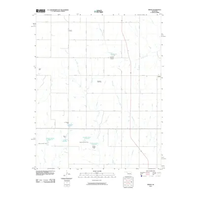
2010 Map of Berlin
USGS Topo · Published 2010About this map
Berlin sits at the edge of this landscape, which is defined by an intricate network of water management features and rural roadways. The area is heavily marked by small reservoirs and dams, reflecting a reliance on controlled water sources for agriculture and livestock in western Oklahoma. Significant water bodies include the D C Thetford Reservoir, Marshall Lake, and the Shotwell Number 1 Reservoir, each supported by named structures like the Shotwell Number 1 Dam.
Find a feature on this map
55 named features on this map. Tap any name to fly to it.
Don’t see what you’re looking for? This feature index may not catch every label — zoom into the map to look around manually.
Map Details
Editions of this 2010 Berlin Map
This is the sole edition of this map. No revisions or reprints were ever made.
Other maps of this area

1955 · Clinton
USGS Topo · 1:250,000

1957 · Clinton
USGS Topo · 1:250,000

1960 · Sweetwater
USGS Topo · 1:62,500

1960 · Cheyenne
USGS Topo · 1:62,500

1960 · Sayre
USGS Topo · 1:62,500

1961 · Reydon
USGS Topo · 1:62,500

1984 · Foss Reservoir
USGS Topo · 1:100,000

1985 · Elk City
USGS Topo · 1:100,000
1988 · Grimes
USGS Topo · 1:24,000

1988 · Dempsey
USGS Topo · 1:24,000