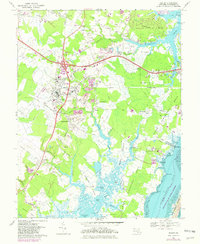
1967 Map of Berlin
USGS Topo · Published 1982About this map
Berlin serves as the focal point of this coastal Maryland landscape, where the inland agricultural patterns of Worcester County meet the tidal reaches of the Sinepuxent Bay. The map documents a community deeply connected to its local heritage, evidenced by the Stephen Decatur Monument and the Stephen Decatur High Sch, honoring the naval hero born in nearby Ironshire. Beyond the town center, a network of smaller settlements like Germantown, Briddletown, and Friendship are connected by roads such as Georgetown Road and the Conrail line. To the east, the geography shifts into the complex waterways of Turville Neck and Golden Quarter, eventually reaching the pristine expanse of the Assateague Island National Seashore. This survey captures the transition between the established millponds of the interior, such as Bassett Millpond, and the maritime infrastructure of Snug Harbor and the Ocean City Airport as coastal development began to intensify in the early 1980s.
Find a feature on this map
86 named features on this map. Tap any name to fly to it.
Don’t see what you’re looking for? This feature index may not catch every label — zoom into the map to look around manually.
Map Details
Editions of this 1967 Berlin Map
3 editions found
Other maps of this area

1901 · Snow Hill
USGS Topo · 1:62,500

1901 · Green Run
USGS Topo · 1:62,500

1901 · Ocean City
USGS Topo · 1:62,500

1902 · Pittsville
USGS Topo · 1:62,500

1938 · Green Run
USGS Topo · 1:62,500

1942 · Ocean City
USGS Topo · 1:62,500

1942 · Ninepin
USGS Topo · 1:24,000

1942 · Ocean City
USGS Topo · 1:24,000

1942 · Tingles Island
USGS Topo · 1:24,000

1942 · Wesley
USGS Topo · 1:24,000