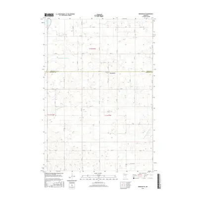
2016 Map of Bernadotte
USGS Topo · Published 2016About this map
Bernadotte serves as a central anchor in this agricultural landscape where Nicollet and Sibley counties meet. The small community is home to the Bernadotte Lutheran Cem, a significant site for local genealogical research and parish history. The surrounding terrain is defined by an extensive drainage network designed to manage the fertile prairie soils, featuring engineered waterways such as Judicial Ditch Number Six, County Ditch Number Forty A, and Judicial Ditch Number One A. These ditches, alongside natural features like Sand Lake and the S Br Rush River, reflect the long-standing efforts to transform this wetland-rich region into productive farmland. The grid-based road system, including Co Hwy 1 and numerous township roads like 330th St, illustrates the organized township-and-range development typical of southern Minnesota.
Find a feature on this map
20 named features on this map. Tap any name to fly to it.
Don’t see what you’re looking for? This feature index may not catch every label — zoom into the map to look around manually.
Map Details
Editions of this 2016 Bernadotte Map
This is the sole edition of this map. No revisions or reprints were ever made.
Other maps of this area

1953 · New Ulm
USGS Topo · 1:250,000

1957 · New Ulm
USGS Topo · 1:250,000

1958 · New Ulm
USGS Topo · 1:250,000

1958 · Gaylord
USGS Topo · 1:62,500

1958 · Winthrop
USGS Topo · 1:62,500

1964 · Bernadotte
USGS Topo · 1:24,000

1964 · New Ulm
USGS Topo · 1:24,000

1964 · Courtland
USGS Topo · 1:24,000

1964 · Lafayette
USGS Topo · 1:24,000

1965 · New Sweden
USGS Topo · 1:24,000