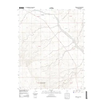
2013 Map of Bernalillo NW
USGS Topo · Published 2013About this map
Zia Pueblo occupies the northern reaches of this high-desert landscape, situated along the meandering course of the Jemez River. The terrain is defined by a complex network of ephemeral drainages, including the wide sandy bed of Arroyo Arenoso and the winding Arroyo Onto, which carve through the arid plateaus. While the southern portion of the quadrangle shows the expanding municipal footprint of Rio Rancho, much of the central and eastern sections remain sparsely developed, characterized by ranching landmarks like the Jemez Windmill. This 2013 survey illustrates the intersection of ancient tribal lands and modern suburban growth in Sandoval County, providing a clear record of the area's hydrology and land divisions before further development altered the desert floor.
Find a feature on this map
13 named features on this map. Tap any name to fly to it.
Don’t see what you’re looking for? This feature index may not catch every label — zoom into the map to look around manually.
Map Details
Editions of this 2013 Bernalillo NW Map
This is the sole edition of this map. No revisions or reprints were ever made.
Other maps of this area

1888 · Bernalillo
USGS Topo · 1:125,000

1889 · Albuquerque
USGS Topo · 1:125,000

1890 · Jemes
USGS Topo · 1:125,000

1892 · Jemes
USGS Topo · 1:125,000

1893 · Albuquerque
USGS Topo · 1:125,000

1939 · San Ysidro
USGS Topo · 1:62,500

1943 · San Ysidro
USGS Topo · 1:62,500

1943 · Jemez
USGS Topo · 1:62,500

1952 · Jemez
USGS Topo · 1:62,500

1953 · Bernalillo NW
USGS Topo · 1:24,000