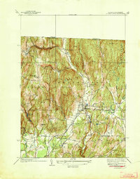
1941 Map of Bernardston
USGS Topo · Published 1941About this map
The Falls River carves a central path through this pre-war landscape, defining the character of Bernardston and its surrounding hill towns. In 1936, surveyors Roscoe Reeves and G.E. Sisson recorded a rural economy organized around river valleys and ridge roads, where the Boston and Maine Railroad and the riverside Hales Crossing provided vital connections for local industry and transport. The map reveals the intricate network of schoolhouses serving small hilltop communities, from East Hill Sch near Frizzell Hill to the Sunnyside Sch in Gill.
Find a feature on this map
52 named features on this map. Tap any name to fly to it.
Don’t see what you’re looking for? This feature index may not catch every label — zoom into the map to look around manually.
Map Details
Editions of this 1941 Bernardston Map
3 editions found
Other maps of this area

1887 · Warwick
USGS Topo · 1:62,500

1889 · Warwick
USGS Topo · 1:62,500

1890 · Greenfield
USGS Topo · 1:62,500

1891 · Brattleboro
USGS Topo · 1:62,500

1893 · Brattleboro
USGS Topo · 1:62,500

1894 · Greenfield
USGS Topo · 1:62,500

1894 · Warwick
USGS Topo · 1:62,500

1898 · Keene
USGS Topo · 1:62,500

1932 · Brattleboro
USGS Topo · 1:48,000

1932 · Warwick
USGS Topo · 1:48,000