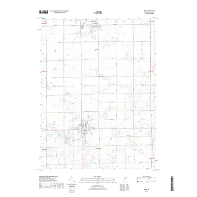
2019 Map of Berne
USGS Topo · Published 2019About this map
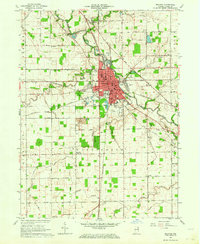
The settlement of Berne and its surrounding agricultural landscape in Adams County are defined by an intricate network of drainage ditches that transformed this portion of Indiana. Numerous family and local cemeteries are scattered throughout the rural sections, including Mazelin Cem, Graber Cem, and Ray Cem, providing essential markers for genealogists tracing local history. The town of Monroe and the smaller crossroads of Coppess Corner anchor the northern portion of the survey, while the southern boundary follows the path of the Wabash River. The landscape is a testament to the engineering required for modern farming, with named watercourses like Wittmer Number One Ditch and Habegger Ditch crisscrossing the township lines. This documentation of the area's hydrography and infrastructure highlights the transition from natural wetlands to a highly structured rural grid.
Find a feature on this map
81 named features on this map. Tap any name to fly to it.
Don’t see what you’re looking for? This feature index may not catch every label — zoom into the map to look around manually.
Map Details
Editions of this 2019 Berne Map
This is the sole edition of this map. No revisions or reprints were ever made.
Other maps of this area

1911 · Berne
USGS Topo · 1:48,000

1953 · Muncie
USGS Topo · 1:250,000

1956 · Muncie
USGS Topo · 1:250,000
1960 · New Corydon
USGS Topo · 1:24,000
1960 · Wren
USGS Topo · 1:24,000
1960 · Willshire
USGS Topo · 1:24,000

1962 · Preble
USGS Topo · 1:24,000

1962 · Berne
USGS Topo · 1:24,000
1962 · Decatur
USGS Topo · 1:24,000

1962 · Linn Grove
USGS Topo · 1:24,000