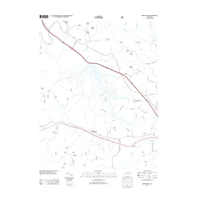
2013 Map of Bernstadt
USGS Topo · Published 2013About this map
Bernstadt serves as a focal point in this southern Kentucky landscape, situated amidst a complex network of ridges and watercourses. The central geography is dominated by Wood Creek Lake, a sprawling reservoir fed by Wood Wood Cr and Jones Fork. This 2013 survey illustrates the rugged topography of the Daniel Boone National Forest region, where the Rockcastle River and Little Rockcastle River carve through the terrain. Evidence of the area's transportation engineering is visible in the series of sequential tunnels, from Tunnel Number 6 to Tunnel Number 9, which pierce the high ground near Arthur Ridge and Johnson Ridge. To the north, the settlement of Hazel Patch marks a historic transit point near the confluence of Hazel Patch Cr and the river. The map also documents numerous family-named hollows and branches, such as Begley Hollow, Philpot Hollow, and Billy Br, providing valuable spatial context for local genealogical research and land use history.
Find a feature on this map
85 named features on this map. Tap any name to fly to it.
Don’t see what you’re looking for? This feature index may not catch every label — zoom into the map to look around manually.
Map Details
Editions of this 2013 Bernstadt Map
This is the sole edition of this map. No revisions or reprints were ever made.
Other maps of this area

1893 · London
USGS Topo · 1:125,000

1897 · London
USGS Topo · 1:125,000

1952 · Lily
USGS Topo · 1:24,000

1952 · London SW
USGS Topo · 1:24,000

1952 · Billows
USGS Topo · 1:24,000

1952 · Ano
USGS Topo · 1:24,000

1952 · Bernstadt
USGS Topo · 1:24,000

1952 · London
USGS Topo · 1:24,000

1953 · Livingston
USGS Topo · 1:24,000

1953 · Mount Vernon
USGS Topo · 1:24,000