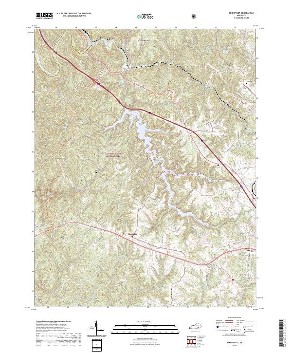
2022 Map of Bernstadt
USGS Topo · Published 2022About this map
Bernstadt serves as a central point in this part of Laurel County, where the plateau begins its descent toward the rugged breaks of the Rockcastle River. This landscape is defined by the transition from the edge of London into the sprawling woodland of the Daniel Boone National Forest. A network of historic paths and ridges, including the Cromer Ridge Sheltowee Trace NRT and the Sheltowee Trace Trail, follows the high ground between deep hollows like Philpot Hollow and King Hollow. These trails trace the same corridors once used by early travelers moving through the Hazel Patch area. The map reveals a settlement pattern of family-named landmarks and rural burial grounds such as Whitt Cemetery and Snuffer Cemetery, which remain tucked away near the headwaters of Wood Creek and the North Prong White Oak Creek.
Find a feature on this map
76 named features on this map. Tap any name to fly to it.
Don’t see what you’re looking for? This feature index may not catch every label — zoom into the map to look around manually.
Map Details
Editions of this 2022 Bernstadt Map
This is the sole edition of this map. No revisions or reprints were ever made.
Other maps of this area

1893 · London
USGS Topo · 1:125,000

1897 · London
USGS Topo · 1:125,000

1952 · Lily
USGS Topo · 1:24,000

1952 · London SW
USGS Topo · 1:24,000

1952 · Billows
USGS Topo · 1:24,000

1952 · Ano
USGS Topo · 1:24,000

1952 · Bernstadt
USGS Topo · 1:24,000

1952 · London
USGS Topo · 1:24,000

1953 · Livingston
USGS Topo · 1:24,000

1953 · Mount Vernon
USGS Topo · 1:24,000