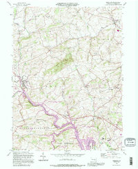
1992 Map of Bernville
USGS Topo · Published 1995About this map
Bernville sits at the western edge of this Berks County landscape, where the waters of Little Northkill Creek and Tulpehocken Creek converge. The southern portion of the sheet is dominated by the sprawling reaches of Blue Marsh Lake, a significant water feature that transformed the local drainage pattern of Spring Creek and Licking Creek. This 1990s inspection records a mix of rural heritage and institutional development, evidenced by the cluster of the County Home and Hospital, County Prison, and County Sanatorium in the southeast corner near Camp Joy.
Find a feature on this map
43 named features on this map. Tap any name to fly to it.
Don’t see what you’re looking for? This feature index may not catch every label — zoom into the map to look around manually.
Map Details
Editions of this 1992 Bernville Map
This is the sole edition of this map. No revisions or reprints were ever made.
Other maps of this area

1889 · Pottsville
USGS Topo · 1:62,500

1891 · Pottsville
USGS Topo · 1:62,500

1894 · Reading
USGS Topo · 1:62,500

1902 · Wernersville
USGS Topo · 1:62,500

1909 · Hamburg
USGS Topo · 1:62,500

1911 · Hamburg
USGS Topo · 1:62,500

1913 · Reading
USGS Topo · 1:62,500

1915 · Reading
USGS Topo · 1:62,500

1943 · Wernersville
USGS Topo · 1:62,500

1944 · Reading
USGS Topo · 1:62,500
Featured Places
- North Heidelberg Township, PA
- Bernville, PA
- Centerport, PA
- Penn Township, PA
- Lower Heidelberg Township, PA