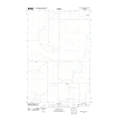
2011 Map of Berry School
USGS Topo · Published 2011About this map
Berry School (Historical) stands as a marker of the educational heritage in this quiet corner of McCone County, where the landscape is defined by the winding course of the Redwater River. This 2011 survey illustrates the rural infrastructure of the High Plains, where remote roads like Chalk Butte Rd and Last Chance Rd provide the primary connections between isolated landmarks and water sources. To the north, the Jordan Reservoir Number 2 Dam regulates local waters, while Trail Creek and Lisk Creek feed into the river system.
Find a feature on this map
12 named features on this map. Tap any name to fly to it.
Don’t see what you’re looking for? This feature index may not catch every label — zoom into the map to look around manually.
Map Details
Editions of this 2011 Berry School Map
This is the sole edition of this map. No revisions or reprints were ever made.
Other maps of this area

1954 · Jordan
USGS Topo · 1:250,000

1954 · Glendive
USGS Topo · 1:250,000

1956 · Jordan
USGS Topo · 1:250,000

1957 · Glendive
USGS Topo · 1:250,000

1958 · Jordan
USGS Topo · 1:250,000

1958 · Glendive
USGS Topo · 1:250,000

1964 · Jordan
USGS Topo · 1:250,000

1965 · Hedstrom Lake
USGS Topo · 1:24,000

1965 · Hedstrom Lake SE
USGS Topo · 1:24,000

1965 · Heitz School
USGS Topo · 1:24,000