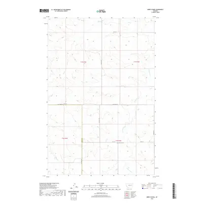
2020 Map of Berry School
USGS Topo · Published 2020About this map
The Redwater River winds through this rural landscape in McCone and Prairie Counties, defining a region where water sources dictated the patterns of early settlement. This area is characterized by a network of seasonal drainages including Skull Cr, Trail Cr, and Huy Cr, which intersect with a grid of remote roads such as Chalk Butte Rd and Last Chance Rd. For those researching local history, the map preserves the location of the Berry School (historical), marking a site of former community education, and the Watkins Cem located near the intersection of Watkins Rd. The presence of these named landmarks amidst the coulees and high plains provides a clear record of the families and social structures that once anchored this part of eastern Montana.
Find a feature on this map
18 named features on this map. Tap any name to fly to it.
Don’t see what you’re looking for? This feature index may not catch every label — zoom into the map to look around manually.
Map Details
Editions of this 2020 Berry School Map
This is the sole edition of this map. No revisions or reprints were ever made.
Other maps of this area

1954 · Jordan
USGS Topo · 1:250,000

1954 · Glendive
USGS Topo · 1:250,000

1956 · Jordan
USGS Topo · 1:250,000

1957 · Glendive
USGS Topo · 1:250,000

1958 · Jordan
USGS Topo · 1:250,000

1958 · Glendive
USGS Topo · 1:250,000

1964 · Jordan
USGS Topo · 1:250,000

1965 · Hedstrom Lake
USGS Topo · 1:24,000

1965 · Hedstrom Lake SE
USGS Topo · 1:24,000

1965 · Heitz School
USGS Topo · 1:24,000