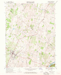
1968 Map of Berryville
USGS Topo · Published 1969About this map
Berryville serves as the focal point of this late 1960s survey, straddling the state line between Virginia and West Virginia. The landscape is defined by the intersection of the Norfolk and Western and Baltimore and Ohio railroads, which facilitated the movement of goods through this agricultural valley. Local institutions are well-documented, including the County Fairground, Johnson Williams High Sch, and several rural houses of worship such as Prosperity Ch and St Johns Ch.
Find a feature on this map
45 named features on this map. Tap any name to fly to it.
Don’t see what you’re looking for? This feature index may not catch every label — zoom into the map to look around manually.
Map Details
Editions of this 1968 Berryville Map
4 editions found
Other maps of this area

1884 · Harpers Ferry
USGS Topo · 1:125,000

1891 · Harpers Ferry
USGS Topo · 1:125,000

1893 · Harpers Ferry
USGS Topo · 1:125,000

1894 · Winchester
USGS Topo · 1:125,000

1914 · Martinsburg
USGS Topo · 1:48,000

1914 · Gerrardstown
USGS Topo · 1:48,000

1916 · Gerrardstown
USGS Topo · 1:62,500

1916 · Martinsburg
USGS Topo · 1:62,500

1916 · Berryville
USGS Topo · 1:62,500

1937 · Gerrardstown
USGS Topo · 1:48,000