
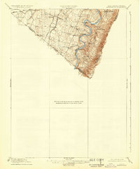
1916 Map of Berryville
USGS Topo · Published 1920About this map
The Shenandoah River snakes through the eastern portion of this landscape, its steep banks flanked by the rising slopes of the Blue Ridge. This era of the valley’s history is defined by its transit corridors, where the Norfolk and Western and Baltimore and Ohio railroads cut across the fertile farmland, connecting agricultural settlements like Summit Point and Rippon to wider markets.
Find a feature on this map
28 named features on this map. Tap any name to fly to it.
Don’t see what you’re looking for? This feature index may not catch every label — zoom into the map to look around manually.
Map Details
Editions of this 1916 Berryville Map
2 editions found
Other maps of this area

1884 · Harpers Ferry
USGS Topo · 1:125,000

1891 · Harpers Ferry
USGS Topo · 1:125,000

1893 · Luray
USGS Topo · 1:125,000

1893 · Harpers Ferry
USGS Topo · 1:125,000

1894 · Warrenton
USGS Topo · 1:125,000

1894 · Winchester
USGS Topo · 1:125,000

1905 · Luray
USGS Topo · 1:125,000

1908 · Middletown
USGS Topo · 1:48,000

1910 · Antietam
USGS Topo · 1:62,500

1914 · Martinsburg
USGS Topo · 1:48,000