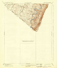
1916 Map of Berryville
USGS Topo · Published 1933About this map
The Shenandoah River snakes through the landscape, defining a region where water and rail dictated the pace of development. Surveyed in 1914, this terrain reveals the early 20th-century character of the borderlands between West Virginia and Virginia. Established river crossings like Myers Ferry and Boyes Ferry remain vital infrastructure, while the high slopes of the Blue Ridge are dotted with cultural landmarks like the Mountain Mission and Furnace School.
Find a feature on this map
28 named features on this map. Tap any name to fly to it.
Don’t see what you’re looking for? This feature index may not catch every label — zoom into the map to look around manually.
Map Details
Editions of this 1916 Berryville Map
2 editions found

Other maps of this area

1884 · Harpers Ferry
USGS Topo · 1:125,000

1891 · Harpers Ferry
USGS Topo · 1:125,000

1893 · Luray
USGS Topo · 1:125,000

1893 · Harpers Ferry
USGS Topo · 1:125,000

1894 · Warrenton
USGS Topo · 1:125,000

1894 · Winchester
USGS Topo · 1:125,000

1905 · Luray
USGS Topo · 1:125,000

1908 · Middletown
USGS Topo · 1:48,000

1910 · Antietam
USGS Topo · 1:62,500

1914 · Martinsburg
USGS Topo · 1:48,000