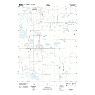
2010 Map of Berthoud
USGS Topo · Published 2010About this map
The town of Berthoud serves as the focal point of this Northern Colorado landscape, where a sophisticated network of early irrigation infrastructure supports the region's agricultural legacy. This system, visible through named channels like Lake Ditch, Home Supply Ditch, and Handy Ditch, feeds an extensive series of catchments including Berthoud Reservoir and Loveland Reservoir. The map reveals the intricate water management required for the high plains, punctuated by numerous dams such as the Lone Tree Dam and Sunny Slope Dam.
Find a feature on this map
113 named features on this map. Tap any name to fly to it.
Don’t see what you’re looking for? This feature index may not catch every label — zoom into the map to look around manually.
Map Details
Editions of this 2010 Berthoud Map
This is the sole edition of this map. No revisions or reprints were ever made.
Other maps of this area

1902 · Greeley
USGS Topo · 1:125,000

1904 · Niwot
USGS Topo · 1:62,500

1906 · Loveland
USGS Topo · 1:62,500

1908 · Loveland
USGS Topo · 1:62,500

1949 · Gowanda
USGS Topo · 1:24,000

1950 · Gowanda
USGS Topo · 1:24,000

1950 · Windsor
USGS Topo · 1:24,000

1950 · Hygiene
USGS Topo · 1:24,000
1950 · Longmont
USGS Topo · 1:24,000

1950 · Johnstown
USGS Topo · 1:24,000