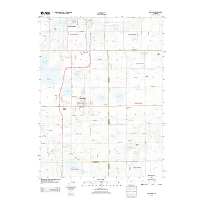
2013 Map of Berthoud
USGS Topo · Published 2013About this map
Berthoud serves as a central hub in this landscape defined by an intricate network of irrigation ditches and reservoirs. The transition between the high plains and the foothills is visible through the diversion of water from the Little Thompson River into numerous man-made channels such as the Handy Ditch, Ish Ditch, and Home Supply Ditch. These waterways support agricultural operations like Pickert's Dairy and local landmarks including the Little Thompson Grange. The settlement pattern follows the established grid of the early 21st century, with the town of Campion and the crossroads at Berts Corner situated along the historic US-287 corridor. To the south, large bodies of water like Ish Reservoir and Highland Lake dominate the terrain, while the Greenlawn Cem and Skylane Ranch Airport provide specific points of interest for local historians and genealogists tracing the development of Larimer County.
Find a feature on this map
94 named features on this map. Tap any name to fly to it.
Don’t see what you’re looking for? This feature index may not catch every label — zoom into the map to look around manually.
Map Details
Editions of this 2013 Berthoud Map
This is the sole edition of this map. No revisions or reprints were ever made.
Other maps of this area

1902 · Greeley
USGS Topo · 1:125,000

1904 · Niwot
USGS Topo · 1:62,500

1906 · Loveland
USGS Topo · 1:62,500

1908 · Loveland
USGS Topo · 1:62,500

1949 · Gowanda
USGS Topo · 1:24,000

1950 · Gowanda
USGS Topo · 1:24,000

1950 · Windsor
USGS Topo · 1:24,000

1950 · Hygiene
USGS Topo · 1:24,000
1950 · Longmont
USGS Topo · 1:24,000

1950 · Johnstown
USGS Topo · 1:24,000