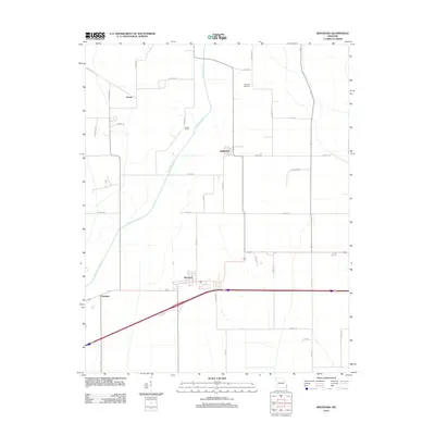
2012 Map of Bertrand
USGS Topo · Published 2012About this map
Bertrand anchors this section of Mississippi County, where the agricultural landscape is defined by the engineered path of North Cut Ditch. This 2012 survey illustrates the precise grid of the Missouri Bootheel, following the expansion of road networks and the persistence of small settlements like Diehlstadt and Porter. The mapping of smaller locations such as Austin Switch and Buckeye highlights the region's history as a freight and transit corridor. Genealogists may find interest in the documented location of Maynard Cemetery, situated among the fields north of the primary settlements. The interplay of regional routes like Co HWY-530 and Co HWY-518 shows the modern evolution of travel in this historically drainage-dependent landscape.
Find a feature on this map
36 named features on this map. Tap any name to fly to it.
Don’t see what you’re looking for? This feature index may not catch every label — zoom into the map to look around manually.
Map Details
Editions of this 2012 Bertrand Map
This is the sole edition of this map. No revisions or reprints were ever made.
Other maps of this area

1931 · Sikeston
USGS Topo · 1:62,500

1934 · Thebes
USGS Topo · 1:62,500

1934 · Morley
USGS Topo · 1:62,500

1934 · Sikeston
USGS Topo · 1:62,500

1939 · Sikeston
USGS Topo · 1:62,500

1939 · Charleston
USGS Topo · 1:62,500

1939 · Morley
USGS Topo · 1:62,500

1939 · Thebes
USGS Topo · 1:62,500

1949 · Paducah
USGS Topo · 1:250,000

1950 · Paducah
USGS Topo · 1:250,000