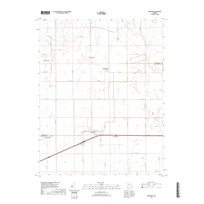
2017 Map of Bertrand
USGS Topo · Published 2017About this map
Bertrand sits at the southern heart of this landscape, where the local road network of W Cedar St and E Cedar St branches out into the surrounding agricultural flats. The terrain is defined by an extensive drainage system necessary for the low-lying Bootheel region, featuring prominent waterways such as North Cut Ditch, Muddy Ditch, and Brushy Lake Ditch. To the north, the small settlement of Diehlstadt anchors the central section of the map, connected to the larger region by State Hwy NN and State Hwy O.
Find a feature on this map
51 named features on this map. Tap any name to fly to it.
Don’t see what you’re looking for? This feature index may not catch every label — zoom into the map to look around manually.
Map Details
Editions of this 2017 Bertrand Map
This is the sole edition of this map. No revisions or reprints were ever made.
Other maps of this area

1931 · Sikeston
USGS Topo · 1:62,500

1934 · Thebes
USGS Topo · 1:62,500

1934 · Morley
USGS Topo · 1:62,500

1934 · Sikeston
USGS Topo · 1:62,500

1939 · Sikeston
USGS Topo · 1:62,500

1939 · Charleston
USGS Topo · 1:62,500

1939 · Morley
USGS Topo · 1:62,500

1939 · Thebes
USGS Topo · 1:62,500

1949 · Paducah
USGS Topo · 1:250,000

1950 · Paducah
USGS Topo · 1:250,000