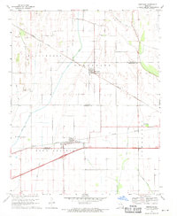
1969 Map of Bertrand
USGS Topo · Published 1971About this map
Bertrand and Diehlstadt anchor this 1969 topographic portrait of the lowlands where Scott and Mississippi Counties meet. The landscape is defined by an intensive network of drainage engineering, with features like Brushy Lake Ditch, Blue Ditch, and Maple Slough Ditch cutting through the terrain to manage the fertile soils of Long Prairie. This drainage system allowed for the agricultural development of areas formerly characterized by the Sandy Woods and bottomlands.
Find a feature on this map
20 named features on this map. Tap any name to fly to it.
Don’t see what you’re looking for? This feature index may not catch every label — zoom into the map to look around manually.
Map Details
Editions of this 1969 Bertrand Map
This is the sole edition of this map. No revisions or reprints were ever made.
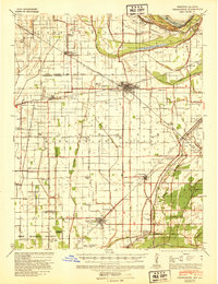
Other maps of this area

1931 · Sikeston
USGS Topo · 1:62,500

1934 · Thebes
USGS Topo · 1:62,500

1934 · Morley
USGS Topo · 1:62,500

1934 · Sikeston
USGS Topo · 1:62,500

1939 · Sikeston
USGS Topo · 1:62,500
1939 · Charleston
USGS Topo · 1:62,500

1939 · Morley
USGS Topo · 1:62,500

1939 · Thebes
USGS Topo · 1:62,500

1949 · Paducah
USGS Topo · 1:250,000

1950 · Paducah
USGS Topo · 1:250,000