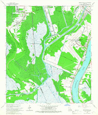
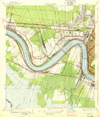
1966 Map of Bertrandville
USGS Topo · Published 1967About this map
The Mississippi River and a complex network of industrial waterways dominate this mid-century view of Jefferson and Plaquemines Parishes. South of New Orleans, the landscape is defined by the intersection of natural bayous and massive engineering projects like the Intracoastal Waterway Harvey Canal No 1 and the Hero Cutoff. Military presence is significant at the U S Naval Air Station (Alvin Callender Field), while industrial activity is evidenced by the Stella Oil and Gas Field. Small riverfront settlements including Oakville, Bertrandville, and Augusta line the levee roads, showing a traditional pattern of Louisiana river settlement. Further inland, marshy terrain is crossed by the Southern Pacific and Missouri Pacific railroads, connecting isolated outposts like Crown Point and schools such as Woodlawn Sch to the broader regional economy.
Find a feature on this map
49 named features on this map. Tap any name to fly to it.
Don’t see what you’re looking for? This feature index may not catch every label — zoom into the map to look around manually.
Map Details
Editions of this 1966 Bertrandville Map
4 editions found
Other maps of this area

1891 · Pointe a La Hache
USGS Topo · 1:62,500

1891 · New Orleans
USGS Topo · 1:62,500

1892 · Barataria
USGS Topo · 1:62,500

1892 · St. Bernard
USGS Topo · 1:62,500

1892 · Pointe a La Hache
USGS Topo · 1:62,500

1932 · New Orleans NE
USGS Topo · 1:31,680

1932 · New Orleans NW
USGS Topo · 1:31,680

1932 · New Orleans SE
USGS Topo · 1:31,680

1932 · New Orleans SW
USGS Topo · 1:31,680
1938 · New Orleans West
USGS Topo · 1:31,680