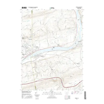
2016 Map of Berwick
USGS Topo · Published 2016About this map
The Susquehanna River carves a deep valley through the ridge-and-valley province of Pennsylvania, serving as the central corridor for the boroughs of Berwick and Nescopeck. This 2016 survey illustrates the persistent industrial and transportation legacy of the region, where the Norfolk Southern rail line follows the northern bank through East Berwick and Beach Haven. The landscape is defined by the steep rises of Lee Mtn to the north and Nescopeck Mtn to the south, containing the river's path and influencing the placement of smaller upland settlements like Zenith and Briggsville. Water management features such as the Glen Brook Reservoir and the presence of islands like Hess Island and Rocky Island reflect the long-standing human engineering of the river's course for municipal and industrial use.
Find a feature on this map
130 named features on this map. Tap any name to fly to it.
Don’t see what you’re looking for? This feature index may not catch every label — zoom into the map to look around manually.
Map Details
Editions of this 2016 Berwick Map
This is the sole edition of this map. No revisions or reprints were ever made.
Other maps of this area

1889 · Catawissa
USGS Topo · 1:62,500

1892 · Catawissa
USGS Topo · 1:62,500

1892 · Mahanoy
USGS Topo · 1:62,500

1893 · Mahanoy
USGS Topo · 1:62,500

1894 · Catawissa
USGS Topo · 1:62,500

1894 · Shickshinny
USGS Topo · 1:62,500

1894 · Bloomsburg
USGS Topo · 1:62,500

1946 · Sybertsville
USGS Topo · 1:31,680

1946 · Nanticoke
USGS Topo · 1:31,680

1946 · Shickshinny
USGS Topo · 1:31,680
Featured Places
- Berwick, PA
- Nescopeck, PA
- Conyngham Township, PA
- Nescopeck Township, PA
- Berwick Heights, Briar Creek Township