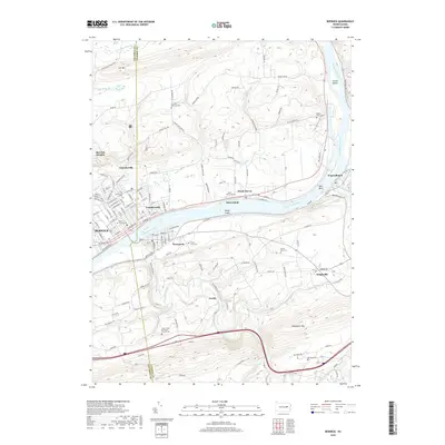
2019 Map of Berwick
USGS Topo · Published 2019About this map
The Susquehanna River carves a central path through this landscape, defining the boundaries between Berwick and its neighbors. Several river features, such as Hess Island, Rocky Island, and Gould Island, are clearly delineated, as is the sharp bend at Bell Bend. The settlement pattern follows the river's course, with established street grids in Berwick and Nescopeck transitioning into upland communities like Berwick Heights and Foundryville.
Find a feature on this map
151 named features on this map. Tap any name to fly to it.
Don’t see what you’re looking for? This feature index may not catch every label — zoom into the map to look around manually.
Map Details
Editions of this 2019 Berwick Map
This is the sole edition of this map. No revisions or reprints were ever made.
Other maps of this area

1889 · Catawissa
USGS Topo · 1:62,500

1892 · Catawissa
USGS Topo · 1:62,500

1892 · Mahanoy
USGS Topo · 1:62,500

1893 · Mahanoy
USGS Topo · 1:62,500

1894 · Catawissa
USGS Topo · 1:62,500

1894 · Shickshinny
USGS Topo · 1:62,500

1894 · Bloomsburg
USGS Topo · 1:62,500

1946 · Sybertsville
USGS Topo · 1:31,680

1946 · Nanticoke
USGS Topo · 1:31,680

1946 · Shickshinny
USGS Topo · 1:31,680
Featured Places
- Berwick, PA
- Nescopeck, PA
- Conyngham Township, PA
- Nescopeck Township, PA
- Berwick Heights, Briar Creek Township