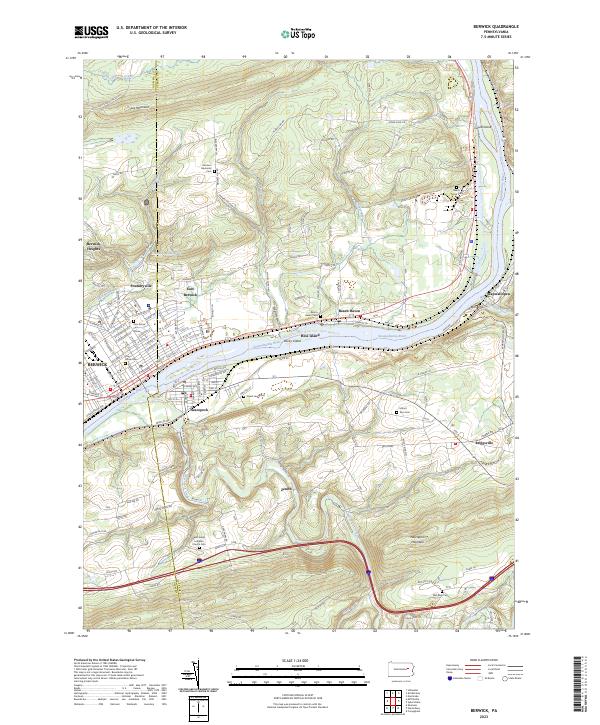
2023 Map of Berwick
USGS Topo · Published 2023About this map
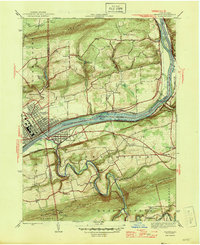
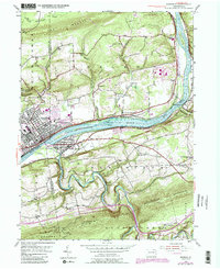
Berwick and Nescopeck face one another across the Susquehanna River, connected by a long-standing bridge network that serves as a focal point for this section of the valley. The river corridor is shaped by natural landmarks like Hess Island and Rocky Island, while the Susquehanna River Water Trail - North Branch Trl follows the northern bank. The terrain rises sharply to the north toward Lee Mountain and to the south toward the massive ridge of Nescopeck Mountain, creating a confined industrial and residential corridor.
Find a feature on this map
168 named features on this map. Tap any name to fly to it.
Don’t see what you’re looking for? This feature index may not catch every label — zoom into the map to look around manually.
Map Details
Editions of this 2023 Berwick Map
This is the sole edition of this map. No revisions or reprints were ever made.
Historical Maps of East Berwick Through Time
3 maps found