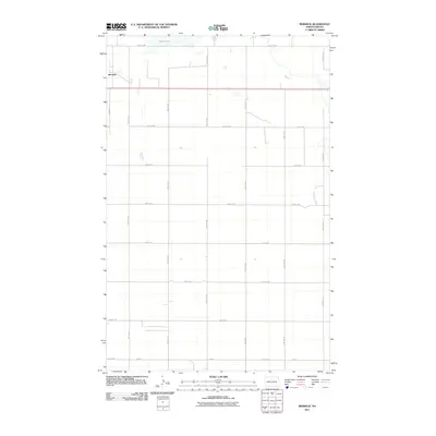
2011 Map of Berwick
USGS Topo · Published 2011About this map
Berwick stands as the primary settlement on this agricultural landscape in McHenry County, situated along a prominent east-west transportation corridor. The terrain is characterized by a precise rectilinear grid of section roads, including 18th Ave NE and 66th St NE, which define the vast farm tracts of the region. To the north, the waters of Rush Lake dominate the drainage pattern, surrounded by smaller, unnamed prairie potholes and seasonal wetlands typical of this part of North Dakota. The concentration of structures in Berwick near Berwick Ln contrasts with the surrounding open country, reflecting the traditional role of small towns as hubs for the rural grain-farming economy during the early 21st century.
Find a feature on this map
18 named features on this map. Tap any name to fly to it.
Don’t see what you’re looking for? This feature index may not catch every label — zoom into the map to look around manually.
Map Details
Editions of this 2011 Berwick Map
This is the sole edition of this map. No revisions or reprints were ever made.
Other maps of this area

1954 · Tunbridge
USGS Topo · 1:24,000

1954 · Towner NE
USGS Topo · 1:24,000

1954 · Berwick
USGS Topo · 1:24,000

1954 · Round Lake
USGS Topo · 1:24,000

1954 · Leverich
USGS Topo · 1:24,000

1954 · Towner SE
USGS Topo · 1:24,000

1954 · Minot
USGS Topo · 1:250,000

1955 · Rangeley NE
USGS Topo · 1:24,000

1958 · Minot
USGS Topo · 1:250,000
1958 · Balta NW
USGS Topo · 1:24,000