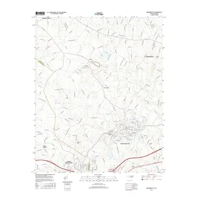
2016 Map of Bessemer City
USGS Topo · Published 2016About this map
Bessemer City serves as the primary urban hub of this Gaston County landscape, showing a dense street grid that includes the intersections of Alabama, Carolina, and Virginia Avenues. The area is defined by a transition from industrial and municipal infrastructure, such as the Bessemer City Reservoir, to the prominent elevations of Chestnut Ridge and Pasour Mtn. Along the western edge, the border between Gaston and Cleveland counties cuts through the terrain near the outskirts of Kings Mountain.
Find a feature on this map
210 named features on this map. Tap any name to fly to it.
Don’t see what you’re looking for? This feature index may not catch every label — zoom into the map to look around manually.
Map Details
Editions of this 2016 Bessemer City Map
This is the sole edition of this map. No revisions or reprints were ever made.
Other maps of this area

1906 · Kings Mountain
USGS Topo · 1:62,500

1908 · Kings Mountain
USGS Topo · 1:62,500

1909 · Lincolnton
USGS Topo · 1:62,500

1911 · Lincolnton
USGS Topo · 1:62,500

1914 · Gastonia
USGS Topo · 1:48,000

1916 · Gastonia
USGS Topo · 1:62,500

1947 · Clover
USGS Topo · 1:62,500

1949 · Clover
USGS Topo · 1:62,500

1953 · Charlotte
USGS Topo · 1:250,000

1954 · Charlotte
USGS Topo · 1:250,000