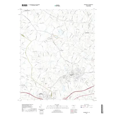
2019 Map of Bessemer City
USGS Topo · Published 2019About this map
Bessemer City serves as the central hub of this map, situated within the rolling foothills where Gaston and Cleveland Counties meet. The landscape is defined by its numerous small waterways, including Long Cr and Abernethy Cr, which drain the varied topography of Chestnut Ridge and Pasour Mtn. The settlement pattern follows a network of rural roads and historical landmarks such as Tryon and Sunnyside, illustrating the transition from open agricultural land to the developed outskirts of Gastonia and Kings Mountain. Cultural and community centers are well-documented, featuring institutions like Tryon School and local congregations including Saint Marks Church and Concord Church. The presence of the Bessemer City Reservoir and Westview Gardens Cem provides specific points of interest for those studying the local utility infrastructure and genealogical sites of the region.
Find a feature on this map
221 named features on this map. Tap any name to fly to it.
Don’t see what you’re looking for? This feature index may not catch every label — zoom into the map to look around manually.
Map Details
Editions of this 2019 Bessemer City Map
This is the sole edition of this map. No revisions or reprints were ever made.
Other maps of this area

1906 · Kings Mountain
USGS Topo · 1:62,500

1908 · Kings Mountain
USGS Topo · 1:62,500

1909 · Lincolnton
USGS Topo · 1:62,500

1911 · Lincolnton
USGS Topo · 1:62,500

1914 · Gastonia
USGS Topo · 1:48,000

1916 · Gastonia
USGS Topo · 1:62,500

1947 · Clover
USGS Topo · 1:62,500

1949 · Clover
USGS Topo · 1:62,500

1953 · Charlotte
USGS Topo · 1:250,000

1954 · Charlotte
USGS Topo · 1:250,000