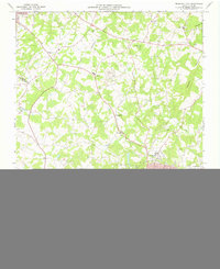
1973 Map of Bessemer City
USGS Topo · Published 1976About this map
Bessemer City serves as the industrial and residential anchor of this 1970s landscape, positioned along the Southern railroad line. The town's grid is clearly defined by named thoroughfares like Maine Ave and Virginia Ave, surrounded by critical community infrastructure including City Hall, the local Library, and Bessemer City High Sch. Outside the urban center, the terrain is shaped by both nature and industry, featuring prominent rises like Chestnut Ridge and Pasour Mountain alongside extensive mining footprints. The presence of multiple Tailings Ponds and designated Mines north of Kings Mountain points to the region's long-standing connection to mineral extraction. Rural life is evidenced by a dense network of country churches such as Hephzibah Ch, Patterson Grove Ch, and Bethel Ch, which remain vital landmarks for local genealogists and historians tracing the settlement patterns of Gaston and Cleveland counties.
Find a feature on this map
67 named features on this map. Tap any name to fly to it.
Don’t see what you’re looking for? This feature index may not catch every label — zoom into the map to look around manually.
Map Details
Editions of this 1973 Bessemer City Map
This is the sole edition of this map. No revisions or reprints were ever made.
Other maps of this area

1906 · Kings Mountain
USGS Topo · 1:62,500

1908 · Kings Mountain
USGS Topo · 1:62,500

1909 · Lincolnton
USGS Topo · 1:62,500

1911 · Lincolnton
USGS Topo · 1:62,500

1914 · Gastonia
USGS Topo · 1:48,000

1916 · Gastonia
USGS Topo · 1:62,500

1947 · Clover
USGS Topo · 1:62,500

1949 · Clover
USGS Topo · 1:62,500

1953 · Charlotte
USGS Topo · 1:250,000

1954 · Charlotte
USGS Topo · 1:250,000