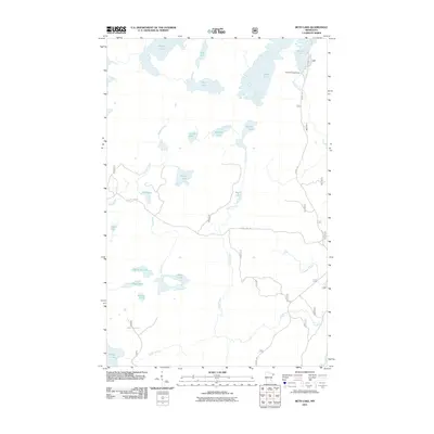
2011 Map of Beth Lake
USGS Topo · Published 2011About this map
Sawbill Campground serves as the primary recreational hub in this northwoods interior, situated at the southern end of Sawbill Lake. The landscape is defined by an intricate network of interconnected waterways, where large bodies like Alton Lake and Beth Lake are linked by drainage systems including Sawbill Creek and Plouff Creek. This 2011 survey captures the primitive road and trail system that facilitates access to the region's interior, featuring the prominent Sawbill Trl and Perent Lake Rd.
Find a feature on this map
28 named features on this map. Tap any name to fly to it.
Don’t see what you’re looking for? This feature index may not catch every label — zoom into the map to look around manually.
Map Details
Editions of this 2011 Beth Lake Map
This is the sole edition of this map. No revisions or reprints were ever made.
Other maps of this area

1954 · Two Harbors
USGS Topo · 1:250,000

1955 · Tofte
USGS Topo · 1:62,500

1955 · Cramer
USGS Topo · 1:62,500

1957 · Two Harbors
USGS Topo · 1:250,000

1958 · Two Harbors
USGS Topo · 1:250,000

1960 · Lake Polly
USGS Topo · 1:24,000

1960 · Kawishiwi Lake
USGS Topo · 1:24,000

1960 · Sawbill Camp
USGS Topo · 1:24,000

1960 · Beth Lake
USGS Topo · 1:24,000
1960 · Cherokee Lake
USGS Topo · 1:24,000