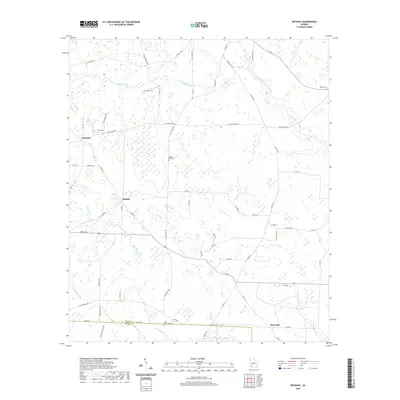
2020 Map of Bethany
USGS Topo · Published 2020About this map
The agrarian landscape of the Baker and Miller County line unfolds across this 2020 topographic record, centered on the small settlements of Bethany and Mimsville. The terrain is defined by its subtle drainage patterns, where Ichawaynochaway Creek and Alligator Cr wind through the eastern reaches, while Little Cypress Cr and Big Cypress Cr meander toward the southwestern corner. This area remains primarily defined by agriculture and local family lineage, as evidenced by several dispersed burial grounds including Stephen Bush Cem, Cedar Grove Cem, and Oak Grove Cem.
Find a feature on this map
58 named features on this map. Tap any name to fly to it.
Don’t see what you’re looking for? This feature index may not catch every label — zoom into the map to look around manually.
Map Details
Editions of this 2020 Bethany Map
This is the sole edition of this map. No revisions or reprints were ever made.
Other maps of this area

1953 · Dothan
USGS Topo · 1:250,000

1954 · Dothan
USGS Topo · 1:250,000

1955 · Dothan
USGS Topo · 1:250,000

1956 · Newton
USGS Topo · 1:62,500

1971 · Hopeful
USGS Topo · 1:24,000

1974 · Damascus
USGS Topo · 1:24,000

1974 · Arlington
USGS Topo · 1:24,000

1974 · Cooktown
USGS Topo · 1:24,000

1974 · Elmodel
USGS Topo · 1:24,000
1974 · Colquitt
USGS Topo · 1:24,000