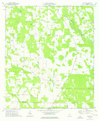
1974 Map of Bethany
USGS Topo · Published 1976About this map
Ichawaynochaway Creek winds through the eastern portion of this South Georgia landscape, defining a rural area where the borders of Baker and Miller counties meet. The settlement patterns in the mid-1970s reflect a decentralized community anchored by local institutions like the Baker Academy and several country churches, including Live Oak Ch and New Evergreen Ch. These sites, along with small family or community burial grounds such as Oak Grove Cem and Cedar Grove Ch Cem, provide critical touchpoints for genealogical research in this agricultural region.
Find a feature on this map
22 named features on this map. Tap any name to fly to it.
Don’t see what you’re looking for? This feature index may not catch every label — zoom into the map to look around manually.
Map Details
Editions of this 1974 Bethany Map
This is the sole edition of this map. No revisions or reprints were ever made.
Other maps of this area

1953 · Dothan
USGS Topo · 1:250,000

1954 · Dothan
USGS Topo · 1:250,000

1955 · Dothan
USGS Topo · 1:250,000

1956 · Newton
USGS Topo · 1:62,500

1971 · Hopeful
USGS Topo · 1:24,000

1974 · Damascus
USGS Topo · 1:24,000

1974 · Arlington
USGS Topo · 1:24,000

1974 · Cooktown
USGS Topo · 1:24,000

1974 · Elmodel
USGS Topo · 1:24,000
1974 · Colquitt
USGS Topo · 1:24,000