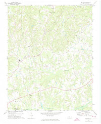
1971 Map of Bethany
USGS Topo · Published 1974About this map
Bakers Crossroads and Wittys Crossroads define the rural crossroads nature of this landscape in northern North Carolina during the early 1970s. The area is characterized by a dense network of country congregations and family burial grounds, including Antioch Ch, St Mariahs Ch, and Howards Chapel Cem, which anchor the local communities. The terrain is deeply carved by water, with Troublesome Creek and its various tributaries such as Jacobs Creek and Little Mill Creek winding through the hills toward the Haw River at the southern edge of the sheet.
Find a feature on this map
37 named features on this map. Tap any name to fly to it.
Don’t see what you’re looking for? This feature index may not catch every label — zoom into the map to look around manually.
Map Details
Editions of this 1971 Bethany Map
This is the sole edition of this map. No revisions or reprints were ever made.
Other maps of this area

1951 · Lake Brandt
USGS Topo · 1:24,000

1951 · Browns Summit
USGS Topo · 1:24,000

1953 · Greensboro
USGS Topo · 1:250,000

1954 · Greensboro
USGS Topo · 1:250,000

1962 · Greensboro
USGS Topo · 1:250,000

1966 · Greensboro
USGS Topo · 1:250,000

1969 · Summerfield
USGS Topo · 1:24,000
1971 · Mayodan
USGS Topo · 1:24,000
1971 · Southeast Eden
USGS Topo · 1:24,000
1971 · Ellisboro
USGS Topo · 1:24,000