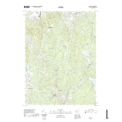
2021 Map of Bethel
USGS Topo · Published 2021About this map
Weir Farm National Historic Site anchors the southern portion of this Fairfield County landscape, preserving the artistic and agricultural legacy of the region. The terrain is defined by a dense network of ridges and water bodies, including Eureka Lake, Saugatuck Reservoir, and Chestnut Ridge Reservoir. The settlement pattern reflects the area's transition from historical villages like West Redding and Branchville to modern suburban density. Genealogists can find several notable burial grounds, such as Children of Israel Cem and the Old Congregational Church Cem near Redding. Significant landmarks like the Danbury Municipal Airport and the forested slopes of Moses Mtn and Wooster Mtn illustrate the balance between mid-20th-century development and the conservation of the rugged Connecticut uplands.
Find a feature on this map
255 named features on this map. Tap any name to fly to it.
Don’t see what you’re looking for? This feature index may not catch every label — zoom into the map to look around manually.
Map Details
Editions of this 2021 Bethel Map
This is the sole edition of this map. No revisions or reprints were ever made.
Other maps of this area

1892 · Stamford
USGS Topo · 1:62,500

1892 · Danbury
USGS Topo · 1:62,500

1892 · Norwalk
USGS Topo · 1:62,500

1892 · Carmel
USGS Topo · 1:62,500

1893 · Carmel
USGS Topo · 1:62,500

1893 · Stamford
USGS Topo · 1:62,500

1893 · Norwalk
USGS Topo · 1:62,500

1894 · Carmel
USGS Topo · 1:62,500

1899 · Stamford
USGS Topo · 1:62,500

1915 · Danbury
USGS Topo · 1:62,500