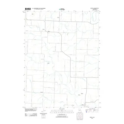
2012 Map of Bethel
USGS Topo · Published 2012About this map
Bethel and its surrounding Shelby County agricultural landscape are defined by a network of waterways including the North River and the Little Fabius River. This 2012 study illustrates the persistent rural settlement patterns of northeastern Missouri, where small hamlets like Plevna, Hebron, and Epworth serve as local anchors. The map is a significant resource for genealogists, as it documents several family and community burial grounds such as Hickman Cemetery, Anderson Cemetery, and Pickett Cemetery. Civil infrastructure is noted through the presence of Palmer Airport in the northwest and the Mann Lake Dam along the Garnett Branch. The terrain is etched by numerous tributaries like Tiger Fork, Owl Creek, and Mesner Branch, showing how the local road system, including Highway BB, follows the high ground between these drainages.
Find a feature on this map
73 named features on this map. Tap any name to fly to it.
Don’t see what you’re looking for? This feature index may not catch every label — zoom into the map to look around manually.
Map Details
Editions of this 2012 Bethel Map
This is the sole edition of this map. No revisions or reprints were ever made.
Other maps of this area

1903 · Kahoka
USGS Topo · 1:125,000

1903 · Palmyra
USGS Topo · 1:125,000

1903 · Edina
USGS Topo · 1:125,000

1948 · Quincy
USGS Topo · 1:250,000

1950 · La Belle
USGS Topo · 1:24,000

1951 · La Belle
USGS Topo · 1:24,000

1953 · Moberly
USGS Topo · 1:250,000

1954 · Centerville
USGS Topo · 1:250,000

1954 · Moberly
USGS Topo · 1:250,000

1956 · Quincy
USGS Topo · 1:250,000