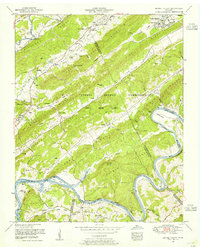
1953 Map of Bethel Valley
USGS Topo · Published 1955About this map
The U S Atomic Energy Commission (Oak Ridge Area) dominates this landscape, reflecting the heavy federal presence in Roane and Anderson counties during the early Cold War. This survey captures a terrain of parallel ridges including Blackoak Ridge and Chestnut Ridge, where small family-named landmarks like the Hembree Cemetery and Currier Cemetery remain within the government reservation. To the south, the Clinch River transitions into Watts Bar Lake, winding through Gallaher Bend and past the White Wing Bridge (Pontoon). The map preserves the locations of early crossroads and rural centers such as Wheat and Bradbury, alongside numerous country churches like Oak Valley Church and Macedonia Church. The presence of a Dismantled railroad and early thoroughfares like Buttermilk Road trace the area's movement patterns before and during the atomic era's expansion.
Find a feature on this map
73 named features on this map. Tap any name to fly to it.
Don’t see what you’re looking for? This feature index may not catch every label — zoom into the map to look around manually.
Map Details
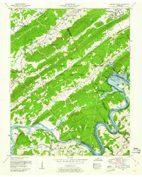
Editions of this 1953 Bethel Valley Map
2 editions found
Other maps of this area

1893 · Briceville
USGS Topo · 1:125,000

1895 · Loudon
USGS Topo · 1:125,000

1895 · Briceville
USGS Topo · 1:125,000

1896 · Briceville
USGS Topo · 1:125,000

1935 · Lenoir City
USGS Topo · 1:24,000

1935 · Elverton
USGS Topo · 1:24,000

1935 · Bethel Valley
USGS Topo · 1:24,000

1935 · Lovell
USGS Topo · 1:24,000

1936 · Cave Creek
USGS Topo · 1:24,000

1936 · Windrock
USGS Topo · 1:24,000