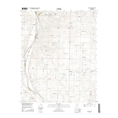
2014 Map of Bethesda
USGS Topo · Published 2014About this map
The White River and its varied tributaries like O'Neal Cr and Lafferty Cr shape this landscape along the border of Independence, Izard, and Stone counties. The settlement pattern is defined by rural communities and family-named ridges, including Collietown, Harmontown, Bethesda, and New Hope. Industrial activity is evident at The Quarry near the eastern edge of the map, while the local history of the region is preserved at sites such as Pilgrims Rest Cem and Campground Cem. Higher elevations like Waugh Mtn and Mose Mtn overlook a network of creek bottoms and hollows, such as Pitman Hollow and McDermon Hollow, which dictate the winding paths of local roads. Small-scale water features like Vaughn Wilson Lake and Waugh Pond appear alongside notable river landmarks including York Island and Speak Point at the southern boundary.
Find a feature on this map
104 named features on this map. Tap any name to fly to it.
Don’t see what you’re looking for? This feature index may not catch every label — zoom into the map to look around manually.
Map Details
Editions of this 2014 Bethesda Map
This is the sole edition of this map. No revisions or reprints were ever made.
Other maps of this area

1890 · Batesville
USGS Topo · 1:125,000

1891 · Batesville
USGS Topo · 1:125,000

1942 · Bethesda
USGS Topo · 1:24,000

1942 · Jamestown
USGS Topo · 1:31,680

1942 · Almond
USGS Topo · 1:31,680

1942 · Batesville
USGS Topo · 1:31,680

1942 · Mt Pleasant
USGS Topo · 1:31,680

1943 · Sandtown
USGS Topo · 1:24,000

1943 · Batesville
USGS Topo · 1:24,000

1953 · Memphis
USGS Topo · 1:250,000