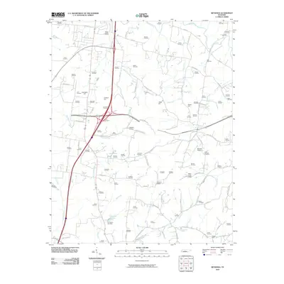
2010 Map of Bethesda
USGS Topo · Published 2010About this map
Family lineages and rural cemetery locations define this portrait of the Tennessee landscape south of Franklin. Dozens of burial grounds, including the Hood-Holt Cemetery, Hardeman Cemetery, and Gosey Cemetery, are scattered across the terrain, reflecting generations of local landownership. The West Harpeth River and Goose Creek wind through the region, while landmarks like Chambers Hill and Duck River Ridge provide significant topographic relief. In the southern portion, the settlement of Cross Keys serves as a local navigational point near the intersection of several country roads. The presence of the Thompson Lake Dam and various hollows like Jackson Hollow and Bennett Hollow suggest a landscape shaped by both water management and natural drainage patterns. This survey provides a precise look at the rural infrastructure and genealogical markers that persist amid modern developments in Williamson County.
Find a feature on this map
111 named features on this map. Tap any name to fly to it.
Don’t see what you’re looking for? This feature index may not catch every label — zoom into the map to look around manually.
Map Details
Editions of this 2010 Bethesda Map
This is the sole edition of this map. No revisions or reprints were ever made.
Other maps of this area

1909 · Franklin
USGS Topo · 1:62,500

1936 · Chapel Hill
USGS Topo · 1:24,000

1936 · Rally Hill
USGS Topo · 1:24,000

1936 · Spring Hill
USGS Topo · 1:24,000

1936 · Carters Creek
USGS Topo · 1:24,000

1936 · Bethesda
USGS Topo · 1:24,000

1941 · Carters Creek
USGS Topo · 1:24,000

1942 · Lebanon
USGS Topo · 1:100,000

1944 · Shelbyville
USGS Topo · 1:100,000

1946 · Leipers Fork
USGS Topo · 1:24,000