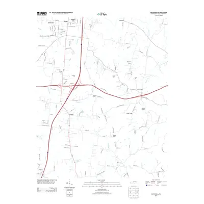
2013 Map of Bethesda
USGS Topo · Published 2013About this map
Bethesda and Peytonsville anchor this rural landscape in Williamson County, where the topography is defined by the winding course of the Harpeth River and the W Harpeth River. The map illustrates a transition between established agricultural areas and emerging suburban residential pockets like Ellington Park and Springview. Historically significant place names such as Little Texas and Cross Keys are recorded alongside natural landmarks like Duck River Ridge and Talley Hill. The drainage patterns of the region are exceptionally detailed, showing numerous tributaries including Starnes Cr, Goose Cr, and McCrory Cr. This modern survey records the evolution of Tennessee's rural roads into a more complex network, while maintaining the identity of family-named hollows such as Jackson Hollow and Johnson Hollow.
Find a feature on this map
145 named features on this map. Tap any name to fly to it.
Don’t see what you’re looking for? This feature index may not catch every label — zoom into the map to look around manually.
Map Details
Editions of this 2013 Bethesda Map
This is the sole edition of this map. No revisions or reprints were ever made.
Other maps of this area

1909 · Franklin
USGS Topo · 1:62,500

1936 · Chapel Hill
USGS Topo · 1:24,000

1936 · Rally Hill
USGS Topo · 1:24,000

1936 · Spring Hill
USGS Topo · 1:24,000

1936 · Carters Creek
USGS Topo · 1:24,000

1936 · Bethesda
USGS Topo · 1:24,000

1941 · Carters Creek
USGS Topo · 1:24,000

1942 · Lebanon
USGS Topo · 1:100,000

1944 · Shelbyville
USGS Topo · 1:100,000

1946 · Leipers Fork
USGS Topo · 1:24,000