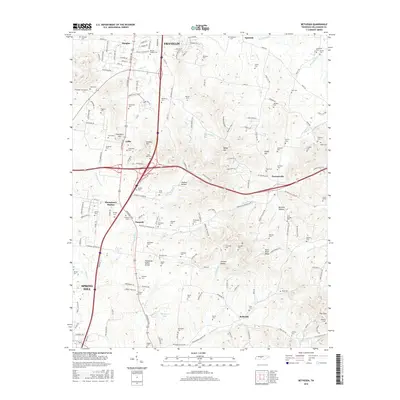
2016 Map of Bethesda
USGS Topo · Published 2016About this map
Franklin and the rolling hill country of southern Williamson County are defined by a dense concentration of family burial grounds and historical rural centers. The terrain is marked by the Tennessee Valley Divide, which separates the watersheds of the Harpeth River and Rutherford Cr. Small settlements like Peytonsville, Bethesda, and Thompson's Station anchor the landscape, connected by a network of winding roads like Arno Rd and Peytonsville Rd. For family historians, the map is remarkably dense with named cemeteries, including Martin-Hughes Cem, Gillespie Cem, and Cool Springs Cem, reflecting the deep-rooted agricultural heritage of this region. The landscape transitions from the developed southern edges of Franklin into the more secluded valleys of Jackson Hollow and Johnson Hollow, where the headwaters of numerous creeks begin their descent toward the West Harpeth.
Find a feature on this map
127 named features on this map. Tap any name to fly to it.
Don’t see what you’re looking for? This feature index may not catch every label — zoom into the map to look around manually.
Map Details
Editions of this 2016 Bethesda Map
This is the sole edition of this map. No revisions or reprints were ever made.
Other maps of this area

1909 · Franklin
USGS Topo · 1:62,500

1936 · Chapel Hill
USGS Topo · 1:24,000

1936 · Rally Hill
USGS Topo · 1:24,000

1936 · Spring Hill
USGS Topo · 1:24,000

1936 · Carters Creek
USGS Topo · 1:24,000

1936 · Bethesda
USGS Topo · 1:24,000

1941 · Carters Creek
USGS Topo · 1:24,000

1942 · Lebanon
USGS Topo · 1:100,000

1944 · Shelbyville
USGS Topo · 1:100,000

1946 · Leipers Fork
USGS Topo · 1:24,000