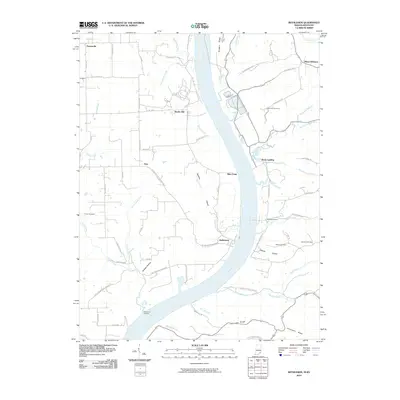
2010 Map of Bethlehem
USGS Topo · Published 2010About this map
The Ohio River carves a sweeping path through this riverfront landscape, defining the border between Indiana and Kentucky. The small settlement of Bethlehem sits at the water's edge, anchored by Bethlehem Reach and a network of rural roads that climb the steep bluffs of Covington Ridge. The terrain is deeply incised by numerous waterways such as Corn Creek, Knob Creek, and Pattons Creek, which have created narrow valleys like Doolittle Hollow and Abbott Hollow.
Find a feature on this map
73 named features on this map. Tap any name to fly to it.
Don’t see what you’re looking for? This feature index may not catch every label — zoom into the map to look around manually.
Map Details
Editions of this 2010 Bethlehem Map
This is the sole edition of this map. No revisions or reprints were ever made.
Other maps of this area

1905 · Prospect
USGS Topo · 1:62,500

1912 · Prospect
USGS Topo · 1:62,500

1932 · La Grange
USGS Topo · 1:62,500

1938 · Owen
USGS Topo · 1:24,000

1939 · Bethlehem
USGS Topo · 1:24,000

1939 · Madison West
USGS Topo · 1:24,000

1948 · Bethlehem
USGS Topo · 1:24,000

1948 · Madison West
USGS Topo · 1:24,000

1948 · Owen
USGS Topo · 1:24,000

1953 · Madison West
USGS Topo · 1:24,000