
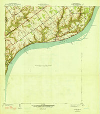
1948 Map of Owen
USGS Topo · Published 1948About this map
Ohio River frontage in Clark County defines this landscape, surveyed just before the onset of World War II. The riverside terrain is marked by notable leisure and military sites, including the recreational grounds of Rose Island Park and the Rose Island Landing near the mouth of Fourteenmile Creek. This period also sees a portion of the northern uplands designated as the Charlestown Military Reservation. Inland, a network of rural schoolhouses such as Golden Valley Sch and Giltner Sch served the surrounding farming communities. Small settlements like Runyantown, Vesta, and Owen provided local centers of gravity, often anchored by country churches like Salem Ch and Owen Creek Ch. The map captures a detailed drainage system where steep hollows like Rabbit Hollow and Dunbar Hollow cut toward the riverbank, framing the agricultural plateaus above.
Find a feature on this map
34 named features on this map. Tap any name to fly to it.
Don’t see what you’re looking for? This feature index may not catch every label — zoom into the map to look around manually.
Map Details
Editions of this 1948 Owen Map
2 editions found
Other maps of this area

1905 · Prospect
USGS Topo · 1:62,500

1912 · Prospect
USGS Topo · 1:62,500

1932 · La Grange
USGS Topo · 1:62,500

1937 · Jeffersonville
USGS Topo · 1:24,000

1937 · Charlestown
USGS Topo · 1:24,000

1938 · Owen
USGS Topo · 1:24,000

1939 · Bethlehem
USGS Topo · 1:24,000

1946 · Jeffersonville
USGS Topo · 1:24,000

1948 · Bethlehem
USGS Topo · 1:24,000
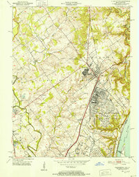
1950 · Charlestown
USGS Topo · 1:24,000